Between July and August of this year, a large increase in coverage was noted in several Latin American countries, including new rural areas as well as upgrades in large metropolitan areas from the peninsula of Baja California in Mexico to the Argentinean Patagonia.
🇲🇽 Mexico
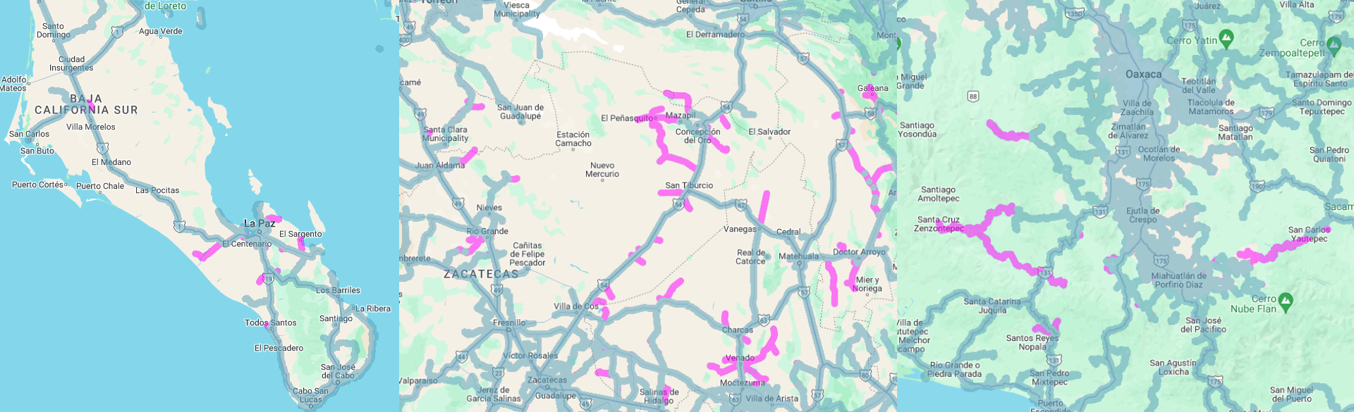
Google has added new views to almost all streets in the Municipality of Concepción de Oro in the State of Zacatecas. This coverage was taken in April.
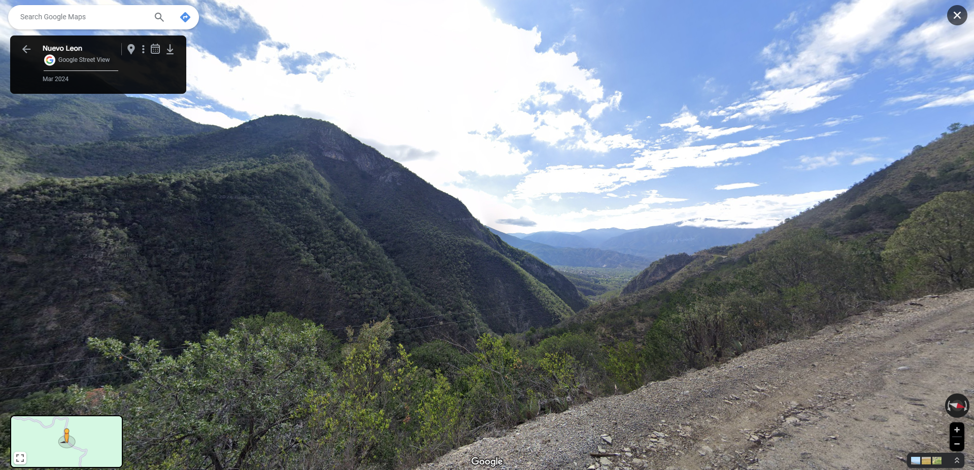
The south of the State of Nuevo León has also obtained a lot of coverage in municipalities such as Hualahuises, Galeana, La Ascención and Iturbide. Scenic byways in the state were also covered in this update including areas around Labrador Lagoon State Park as well as mountain roads connecting the Peña Nevada Natural Park with the municipality of General Zaragoza. These images were taken in March.
Other minor updates include expansion of coverage around the Municipality of El Venado in the State of San Luis de Potosí. Regarding Querétaro, coverage is extended in the northern mountainous area of the state, specifically on the state road QRO 194 that connects to the town of Valle Verde.
Additionally, Oaxaca was one of the southern Mexican states that also received updates that were taken in May, including new views around Santo Domingo Teojomulco.
Additionally, the State of Baja California del Sur received important additions such as new coverage in Ciudad Constitución and El Centenario.
🇨🇴 Colombia
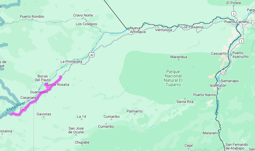
The most important are the first images in the Department of Vichada, specifically in the Municipality of Santa Rosalía, where Google photographed several areas of the locality in March. Hopefully Google Colombia will complete the updates by including views in the departmental capital, Puerto Carreño.
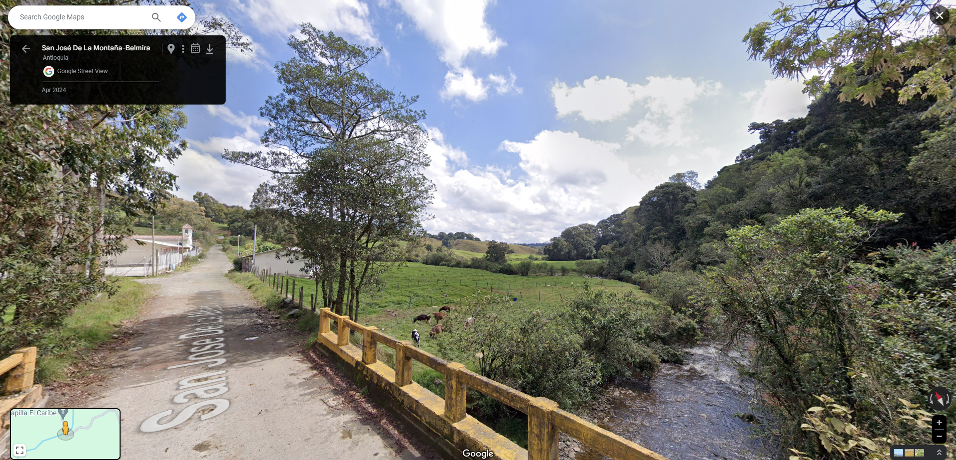
Other departments received new additions such as Peque in the Western Region of Antioquia. Another addition for this department include the San José De La Montaña-Belmira route that crosses near the Páramo de Santa Ines. These images were taken in April.
Additionally, departments in the Andean Region received expansions in rural areas such as Risaralda, where Google photographed in March of this year, the Via al Alto del Oso, where part of the urban area of Pereira can be seen between the mountains.
Finally, the department of Nariño received updates in most urban areas including the port of Tumaco, where the last updates were carried out between 2013 and 2014. In addition, the department received new roads, specifically those connecting towns near the border with Ecuador such as Yaramal and Chiles.
🇵🇪 Peru
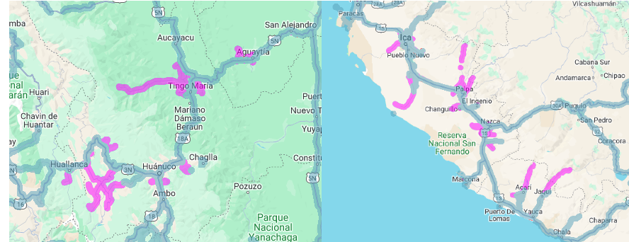
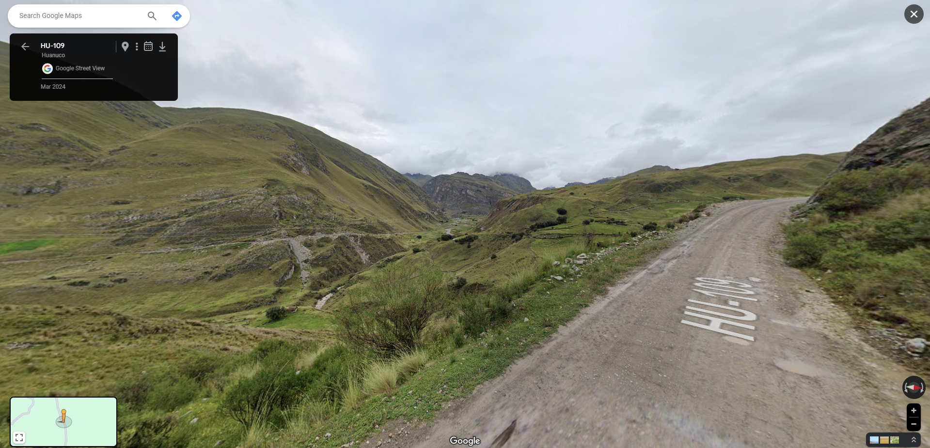
In the Peruvian Amazon, Google has focused on expanding and updating imagery in the Departments of Huánuco and Ucayali, in addition to adding new locations such as Naranjillo and Aguaytia. Specifically in the Department of Huánuco, coverage was also added around the District of Rondos, which was taken in March.
The Department of Ica also received new extensions especially around the city of Nazca where new suburbs were covered such as in Vista Alegre and Portachuelo. In addition, in the province of Palpa, coverage was extended to several roads, such as the one that connects with Tivillo, where around 48 km were covered. In addition, the departmental road IC-108 that connects to the Lomas de Amará Reserve was also covered in this update.
Additionally, new sights have been added in several departments routes such as AN-1263 in Ancash and the AR-102 route in Arequipa.
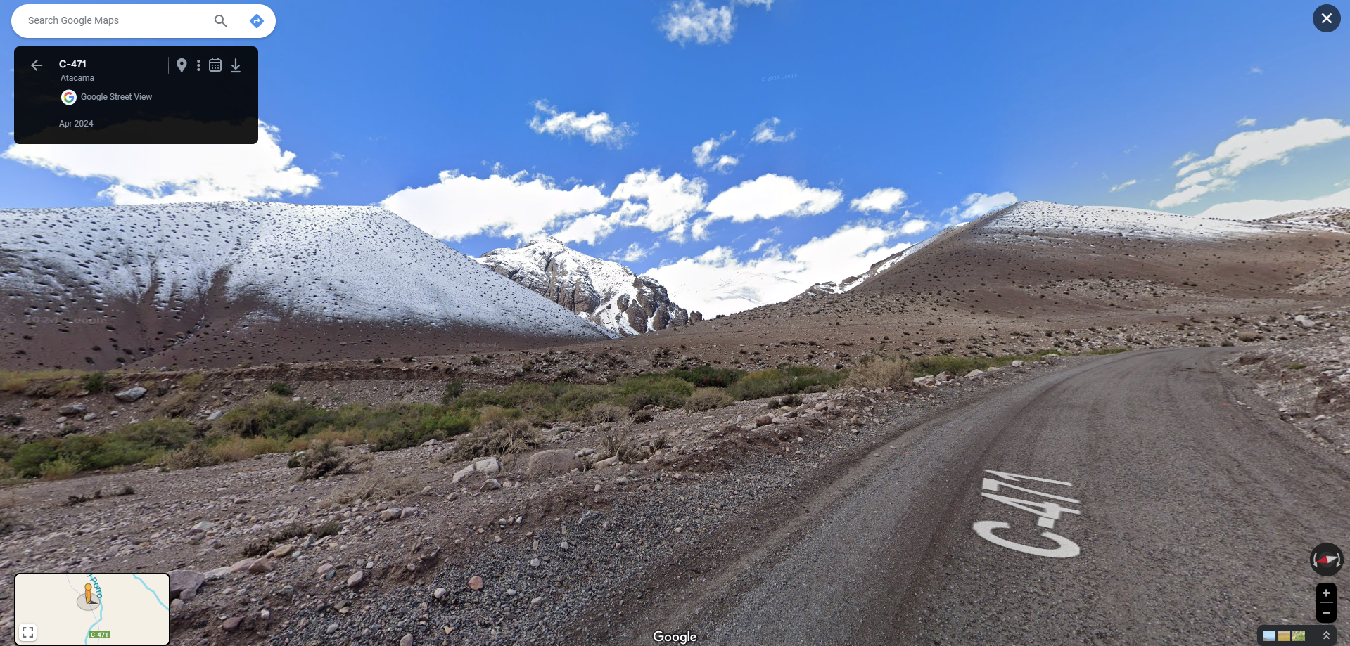
🇨🇱 Chile
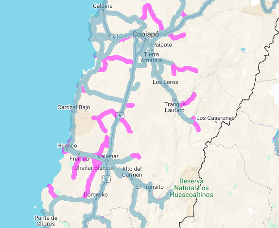
During this update, Google focused on updating and adding new roads around the Atacama Region, including coastal towns such as Carrizal Bajo.
In addition, the Google Chile team has covered several regional roads in this region including the C-471, one of the most remote routes in the region where you can access the Cerro Aperreadero which is approximately 3385 metres high.
Furthermore, Google Chile added views around the southern part of the Desierto Florido National Park, this imagery was taken in March.
🇦🇷 Argentina
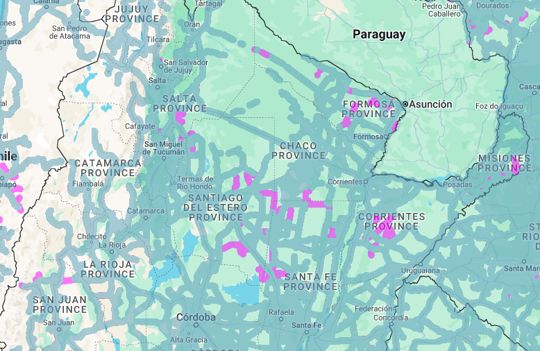
Google Argentina has been trying to expand coverage in the Rio Negro Province, specifically covering new towns such as Darwin, Choele-choel and Lamarque. Regarding the Patagonia region, coverage was also expanded and updated in several suburbs of the city of Trelew in the Province of Chubut.
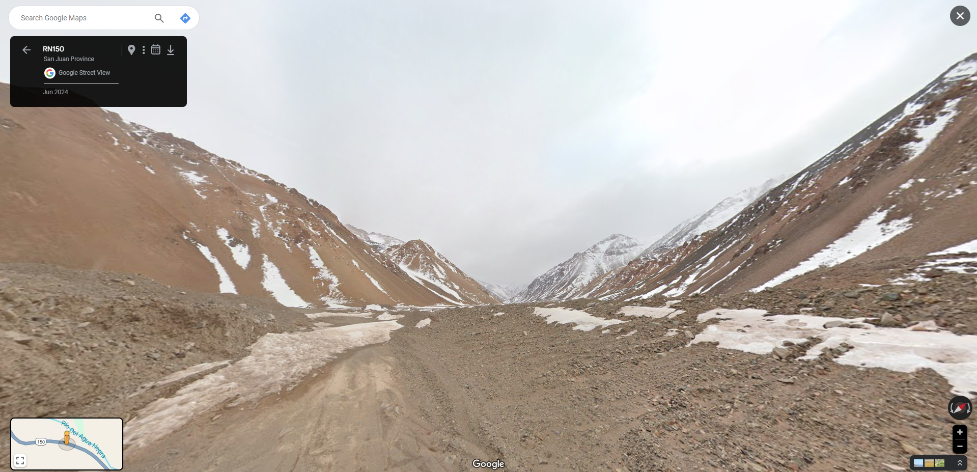
In addition, they have also focused on providing new views of several highways in the country, such as the Ruta Nacional 150 (RN150) which runs in the mountainous area of San Juan Province, specifically around the Cerro Tapita at an altitude of 4170 metres.
Other provinces also received notable expansions such as Misiones, where Google photographed in May several of the suburbs of San Vicente as well as new locations such as Paraíso and San Javier. Regarding the province of Formosa, new sights were added on routes that cross several of the region, such as the Ruta Provincial 6 (RP6) that passes through around Riacho Monte Lindo Grande. In the Province of Buenos Aires, the Ruta Provincial 11 (RP11), which runs through the nature reserve “Parque Costero Sur” in Punta Indio, was also covered in this update.