Earlier this year, Google posted a major list update, which usually occurs every few months. In this list update, we learned about updated coverage in the Dominican Republic and Bolivia, confirming that we’ll see even more Latin American countries receiving updated coverage. However, Google later deleted these entries from the list, potentially meaning that they scrapped the project.
The Dominican Republic was the last country to be properly covered with Gen 3 cameras throughout 2018 and 2019. However, with this update, that’s set to change—the Dominican Republic has been re-added to the list. Currently, only the capital, Santo Domingo, is listed for coverage, but as we’ve seen in Ecuador and Uruguay, it’s likely that the rest of the country will follow. Google plans to cover Santo Domingo between April and May 2025, and we can reasonably expect additional areas to be included afterwards.
Several users in social networks confirmed the sighting of a vehicle equipped with a portable camera navigating the streets of Santo Domingo, specifically in Villas Agrícolas located within the National District. The Dominican Republic has become the second Caribbean country to receive imagery with these vehicles, which were previously tested in Puerto Rico in 2024.
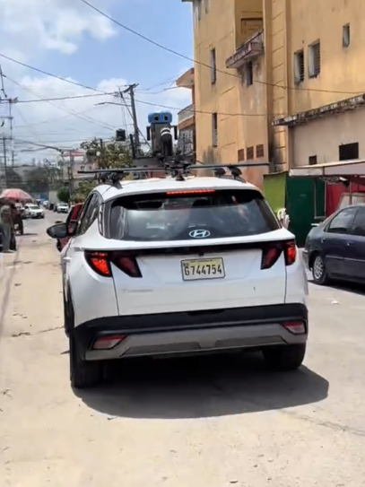
It appears that this comes with a change in Google’s operations in Latin America, where the Caribbean had been a rather neglected area for its Street View project, initially with Google transporting Gen 3 Trekkers to Puerto Rico and the Dominican Republic from its regional offices in Colombia during the 2010s.
In the case of the Dominican Republic, the project was originally carried out by a team led by Tito Gonzalez and the National Institute of Transit and Land Transportation through the defunct “Trekker Loan Program”, where they had the idea of covering the entire island with plans to cover the cities of Punta Cana, Barahona and Romana, but due to logistical problems they could only photograph the metropolitan areas of Santo Domingo and Santiago de los Caballeros in addition to Boca Chica.
Hopefully, this administrative change within Google will enable the mapping team on the island to cover more areas, especially since these portable cameras can be easily mounted on different vehicles. This is evident in the way Google has been filming Puerto Rico; they were able to photograph many more municipalities in a relatively short period of time.
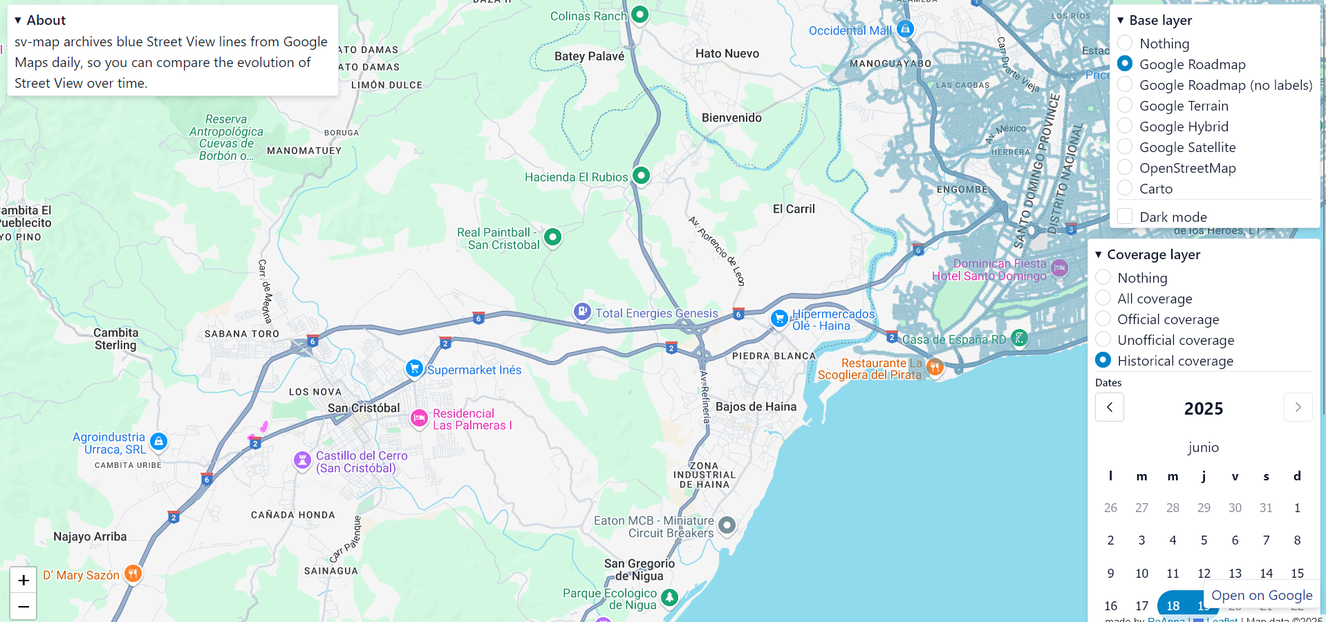
In fact, external tools such as SV Map previously noted changes around certain zones in San Cristobal, a city located west of Santo Domingo, giving us future hopes that coverage will be significantly expanded. Although at the time of writing this article, the coverage is not available, possibly this change was made as a test or accident by the mapping team in the Dominican Republic.
In case you are in the Dominican Republic, we would appreciate any help with photographs as Google does not usually provide much information in certain territories. So feel free to send us a picture of the Google Street View vehicles in the country, in case you have one, any picture helps us a lot.